Bhutan · Story
Bhutan's Himalayan Harmony, from Paro to Punakha and Tiger's Nest
The approach to Paro runs so close to the valley walls that passengers can see washing on the farmhouse lines. From there a single road links the old fortresses of western Bhutan, the capital and the warm valley of Punakha.
The final approach into Paro brings the aircraft so close to the ridges that passengers on the left side can count the prayer flags on the farmhouse roofs. Paro airport lies at about 2,200 metres in a narrow valley, and pilots fly the last minutes visually, banking between the slopes before lining up with the short runway. Only specially trained crews are cleared to land there, and flights operate in daylight. When the doors open, the air is thin and cold and smells of pine.
Bhutan has fewer than 800,000 people and covers an area slightly smaller than Switzerland. It is a Buddhist kingdom on the southern slopes of the eastern Himalaya, between India and Tibet, and it kept itself largely closed to tourism until 1974. The first impressions of Bhutan are much the same for most travellers: whitewashed fortresses, men and women in the national dress of gho and kira, steep rice terraces and a quiet that seems unlikely for a capital region.
Plan your visit
- Getting there
- Druk Air and Bhutan Airlines to Paro from Delhi, Kolkata, Kathmandu and Bangkok; overland at Phuentsholing More
- Base
- The Paro valley for the first and last nights, near the airport and the Tiger's Nest trail More
- Season
- Spring and autumn; hotels fill quickly around the Paro and Thimphu tsechus More
Arrival in the Paro valley
Paro is a valley town rather than a city, a main street of painted wooden shopfronts beside the Paro Chhu river. Above it stands Rinpung Dzong, a fortress-monastery built in 1646 under Zhabdrung Ngawang Namgyal, the Tibetan lama who unified Bhutan in the seventeenth century. Like all the great dzongs, Rinpung houses both district administration and a monastic community, and its inner courtyard is where the masked dances of the Paro Tsechu festival take place each spring.
In the late afternoon the sun drops behind the western ridge early, and the valley fills with shade long before the sky darkens. Wood smoke rises from the farmhouses. Bhutanese rural houses are built of rammed earth or stone with heavy timber frames, their upper floors decorated with painted window frames and symbols meant to protect the household.
Many visitors stay their first and last nights in the Paro valley, since the airport is here and the climb to Tiger’s Nest begins a short drive away. Accommodation ranges from family-run guesthouses to some of the most expensive lodges in Asia.
The road to Thimphu
The road from Paro to Thimphu follows the Paro Chhu downstream to its meeting with the Wang Chhu at Chuzom, where three small chortens mark the confluence, then climbs along the valley to the capital. The drive takes about an hour. Traditional cantilever bridges, strung with prayer flags, cross the rivers at intervals.
Thimphu is one of the highest capitals in the world, laid out along the west bank of the Wang Chhu. It famously has no traffic lights. A signal was tried at the main junction and removed after residents complained, and a police officer still directs cars from a decorated pavilion, white gloves and all. Above the city sits Buddha Dordenma, a giant gilded bronze statue completed in the 2010s, its gaze turned down the valley.
On weekends the sound of Thimphu is the sound of archery. Archery is the national sport, and village and club teams compete on long grassy fields where the target stands about 140 metres away, twice the distance used in the Olympics. Teams shout taunts and comments at opposing archers to put them off their aim. When an arrow hits, teammates dance and sing in praise before the next shot. Modern compound bows have largely replaced bamboo ones at serious matches, but the rituals around the game have changed little.
Gross National Happiness, briefly
Bhutan is best known abroad for a phrase. In the 1970s the fourth king, Jigme Singye Wangchuck, said that Gross National Happiness mattered more than Gross National Product, and the idea grew into a development philosophy that shapes national policy. Bhutan now carries out a regular national survey that measures wellbeing across nine domains, among them health, education, cultural diversity, ecological resilience and good governance.
The idea is often misunderstood. Bhutan does not claim to be the happiest country in the world, and it faces real problems, including youth unemployment and the emigration of many young people to Australia and other countries in recent years. What Gross National Happiness provides is a framework for weighing new projects against their effects on culture and the environment. The constitution adopted in 2008 requires that at least 60 per cent of the country remain under forest cover for all time, and Bhutan absorbs more carbon than it emits.
Over the Dochula Pass
From Thimphu the road to Punakha climbs east to the Dochula Pass at about 3,100 metres. On clear mornings, mostly from October to February, the high Himalaya stands along the northern horizon. The peaks visible from here include Gangkar Puensum, Bhutan’s highest mountain at about 7,570 metres.
Here is a side-track. Gangkar Puensum is widely regarded as the highest unclimbed mountain on earth. Several expeditions attempted it in the 1980s, when climbing was briefly permitted, and none reached the summit. Bhutan then banned climbing on peaks above 6,000 metres, partly out of respect for local beliefs that the mountains are home to protective deities, and in 2003 it banned mountaineering altogether. The summit is likely to remain untouched.
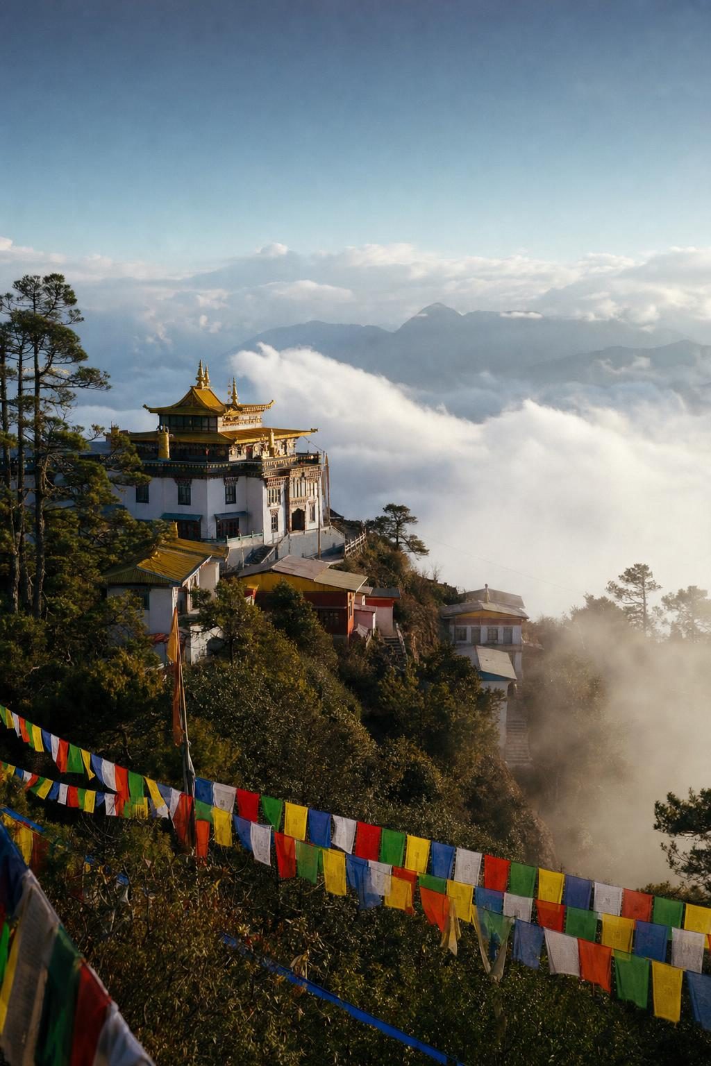
On the pass itself stand the Druk Wangyal Chortens, 108 small stupas arranged in rings on a grassy mound. They were built on the initiative of the Queen Mother, Ashi Dorji Wangmo Wangchuck, to honour Bhutanese soldiers killed in 2003 during an operation to remove Indian insurgent groups that had set up camps in southern Bhutan. Prayer flags in five colours stream from every pole and tree around them.
Punakha and its dzong
The descent from Dochula is long and steep, through oak and rhododendron forest into the warm Punakha valley at around 1,200 metres. Here the air softens, rice grows in terraces along the rivers, and orange and banana trees appear in the village gardens.
Punakha was Bhutan’s capital until 1955.
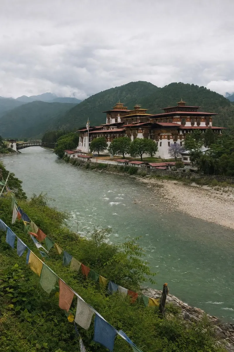
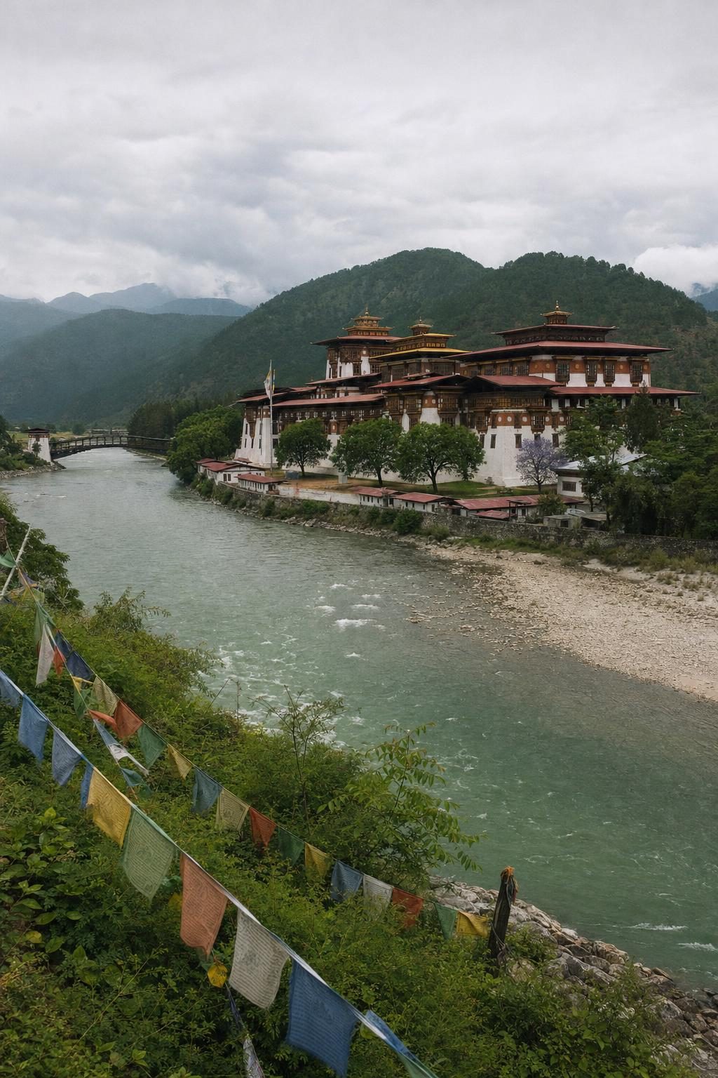
Punakha Dzong stands on a spit of land where two rivers meet, the Pho Chhu and the Mo Chhu, whose names mean father and mother river. Zhabdrung Ngawang Namgyal built it in 1637 to 1638, and it is often called the most beautiful of all the dzongs, with its whitewashed walls, red-trimmed windows and tiered golden roofs. In spring the jacaranda trees in front of it flower purple. The dzong is still the winter residence of the Je Khenpo, the chief abbot of Bhutan, and of the central monk body, which moves between Thimphu and Punakha with the seasons.
Fires, floods and an earthquake have damaged the dzong over the centuries, and it has been restored several times. In 1994 a glacial lake far upstream burst its banks and the resulting flood damaged the building. Glacial lakes in the high valleys are now monitored closely, since warming temperatures have made such outbursts a greater risk.
Laya, the highest valley
North of Punakha, deep inside Jigme Dorji National Park, lies Laya, one of the highest settlements in Bhutan at around 3,800 metres. The Layap people are semi-nomadic herders who keep yaks and are known for their women’s distinctive conical bamboo hats. In recent decades many Layap families have earned significant income from cordyceps, a fungus collected in the high pastures and sold for use in traditional Chinese and Tibetan medicine.
For most visitors Laya is reached on foot, as part of multi-day treks such as the Laya Gasa route or the much longer Snowman trek, which crosses some of the highest passes in the country. Jigme Dorji National Park protects snow leopards, takins, red pandas and Himalayan black bears, and the trails pass through every forest zone from broadleaf to alpine.
The climb to Tiger’s Nest
Back in Paro, most itineraries end with Paro Taktsang, the Tiger’s Nest. The monastery clings to a cliff at about 3,120 metres, roughly 900 metres above the valley floor. According to tradition, Guru Padmasambhava flew here on the back of a tigress in the eighth century and meditated in a cave in the rock. The monastery complex around the cave was built in 1692 by Gyalse Tenzin Rabgye. A fire badly damaged it in 1998, and it was restored by around 2005.
The trail starts at a car park in the upper Paro valley and climbs steadily through pine forest, past water-driven prayer wheels, to a cafeteria with the first close view of the monastery. From a viewpoint opposite the cliff, a stairway drops into a gorge beside a waterfall and climbs back up to the entrance. Most walkers take four to six hours for the round trip. Ponies can carry visitors partway up but not down. Since March 2023 adult visitors have paid an entrance fee, and on certain days of the Bhutanese lunar calendar the monastery is open only to Bhutanese citizens.
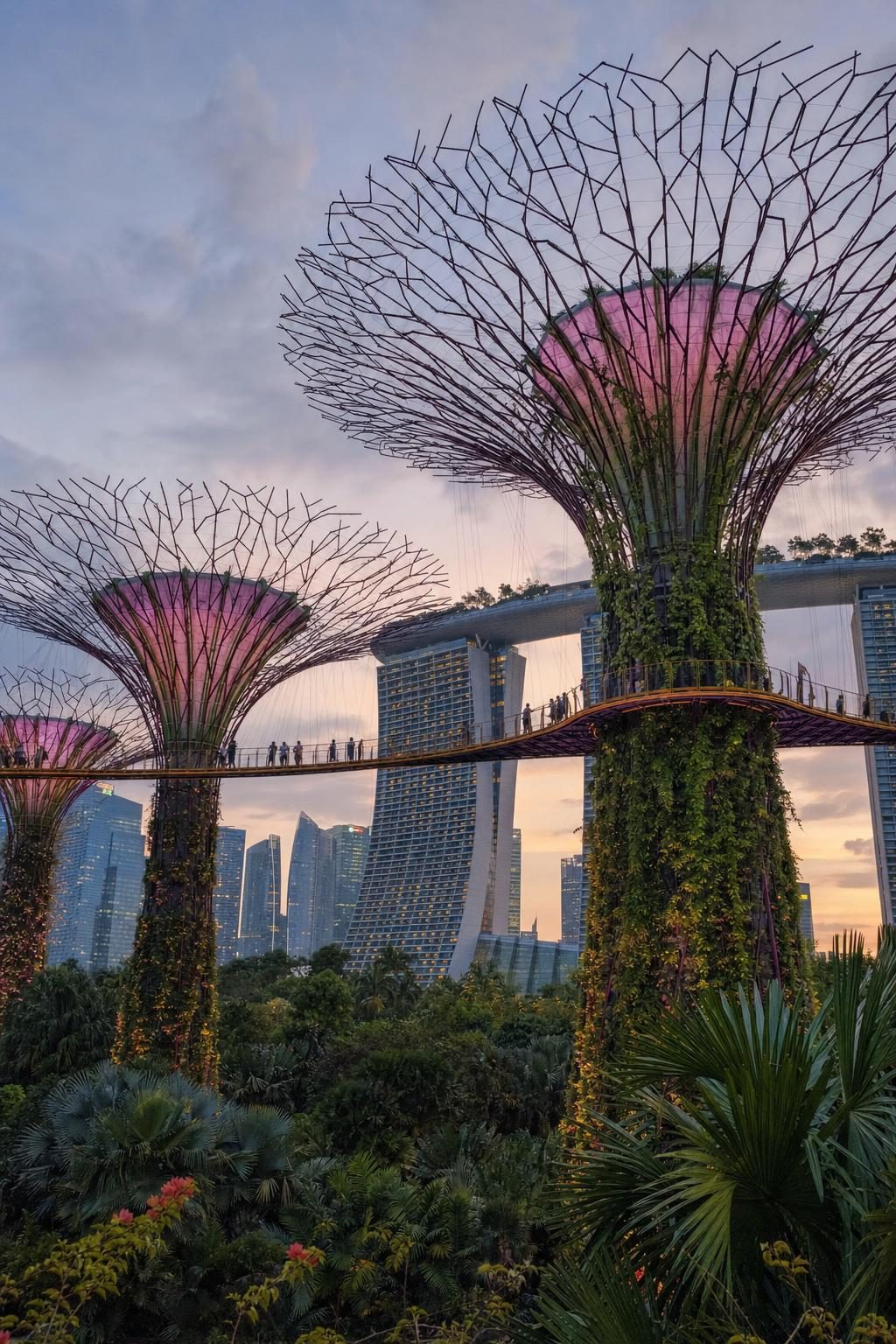
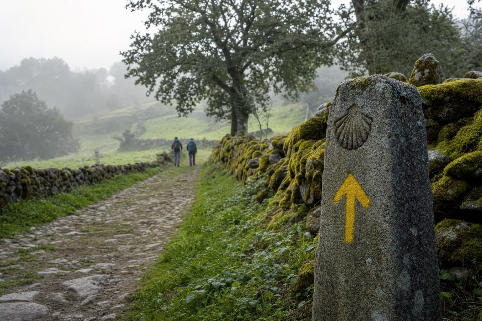
For more on the wider traditions of walking to sacred places, see the history of pilgrimage. The Monpa valleys on the Indian side of the border share much of Bhutan’s culture and are covered in the story of Arunachal Pradesh and the Sela Pass. For a very different approach to greenery in Asia, the planted city of Singapore and Gardens by the Bay makes an interesting contrast.
Planning a trip to Bhutan
Since 2022 Bhutan has charged a Sustainable Development Fee per visitor per night. In September 2023 the rate for adults was halved from USD 200 to USD 100, a reduction the government set to run until August 2027, with lower rates for children and a separate rupee rate for Indian visitors. Visas are issued electronically before arrival. Visitors may book hotels and vehicles independently, but licensed guides are required for most travel beyond Thimphu and Paro and for all treks.
Druk Air and Bhutan Airlines fly into Paro from cities including Delhi, Kolkata, Kathmandu and Bangkok. Overland entry is possible from India at Phuentsholing.
Spring and autumn are the main seasons. The western valleys have the most festivals in those months, but hotel rooms fill quickly around the Paro and Thimphu tsechus. One practical note for anyone eating in local homes: ema datshi, the national dish, is a stew of chillies and cheese in which the chillies are the vegetable, not the seasoning.
Questions before you go
How much is the daily fee to visit Bhutan?
Bhutan charges a Sustainable Development Fee per person per night on top of travel costs. In September 2023 the rate for adult international visitors was cut from USD 200 to USD 100 per night, a rate set to run until August 2027; Indian visitors pay a lower fee in rupees.
Do visitors to Bhutan need a guide?
Visitors can book hotels and transport independently, but licensed guides are required for most travel beyond Thimphu and Paro and for treks. Visas are issued electronically before arrival.
How long does the Tiger's Nest hike take?
Most walkers take four to six hours for the round trip from the car park, including time at the monastery. The monastery stands at about 3,120 metres, roughly 900 metres above the valley floor, and adult visitors pay an entrance fee.
What is Gross National Happiness?
Gross National Happiness is a development philosophy associated with Bhutan's fourth king, Jigme Singye Wangchuck, who argued in the 1970s that the wellbeing of citizens mattered more than economic output. Bhutan now measures it through a national survey covering health, education, culture, environment and governance.
Why is landing at Paro airport difficult?
Paro airport sits in a narrow valley at about 2,200 metres, surrounded by high ridges. Pilots fly visually through the valley and make tight turns before landing, so only specially trained crews are cleared to operate there, and flights run in daylight only.
When was Punakha Dzong built?
Punakha Dzong was built in 1637 to 1638 by Zhabdrung Ngawang Namgyal at the meeting of the Pho Chhu and Mo Chhu rivers. Punakha was Bhutan's capital until 1955, and the dzong still serves as the winter home of the central monk body.
What are the 108 chortens at Dochula?
The Druk Wangyal Chortens are 108 memorial stupas on the Dochula Pass between Thimphu and Punakha. They commemorate the Bhutanese soldiers who died in a 2003 military operation to remove Indian insurgent camps from southern Bhutan.
What is the best time to visit Bhutan?
Spring, from March to May, and autumn, from late September to November, bring the clearest views of the Himalaya and the main festival season. The summer monsoon brings heavy rain and cloud, and winter is cold but often clear in the western valleys.
What is Bhutan's highest mountain?
Gangkar Puensum, at about 7,570 metres, is Bhutan's highest peak and is widely regarded as the highest unclimbed mountain in the world. Bhutan has banned mountaineering on its highest peaks out of respect for local beliefs about mountain spirits.