Morocco · Story
Merzouga Camel Trek: Sunset and a Night in Morocco's Erg Chebbi Dunes
An hour before sunset the dromedaries kneel in a line at the edge of the sand. By dark the riders are deep in the dunes of Erg Chebbi, a short walk from a camp lit by lanterns and a long way from any road.
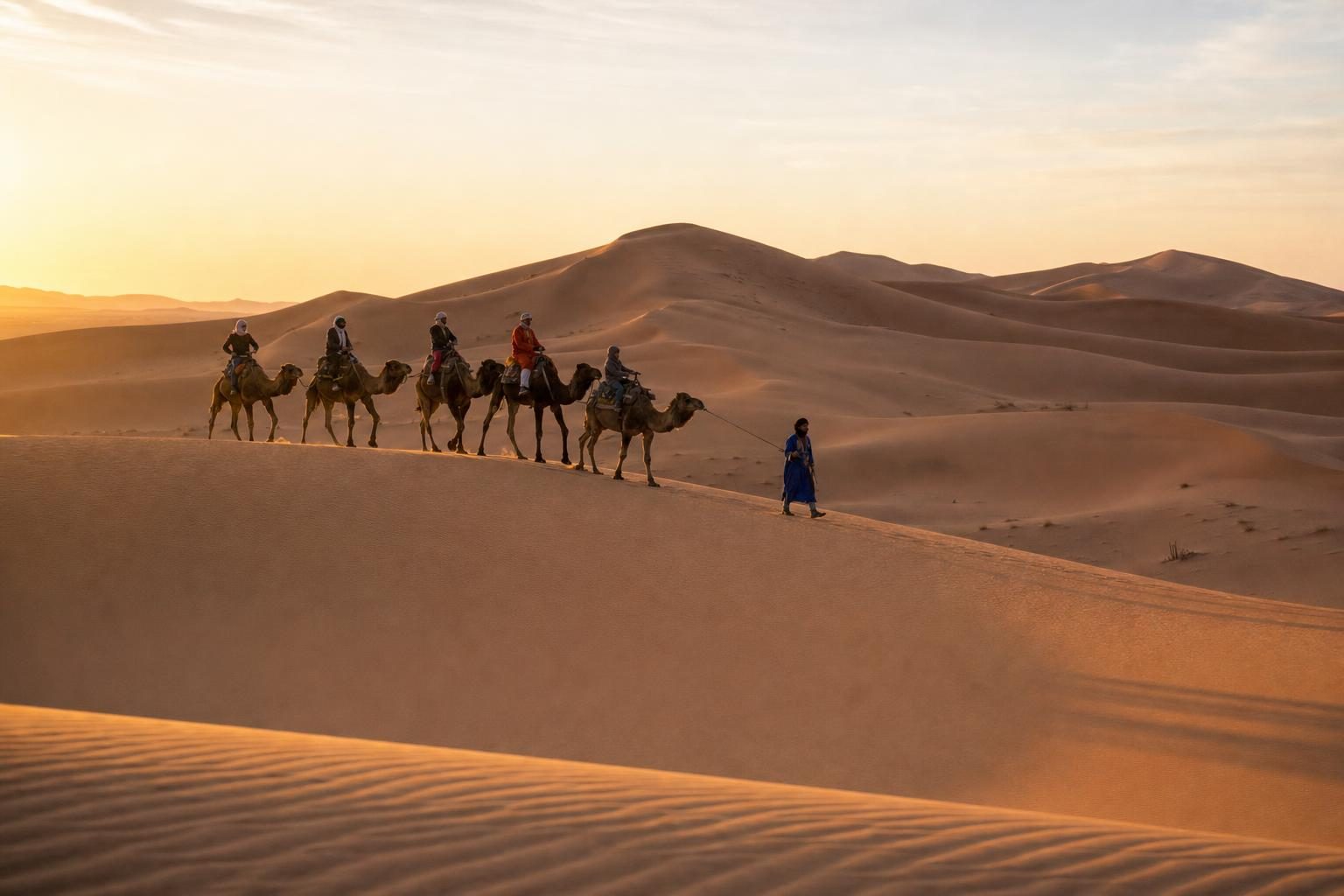
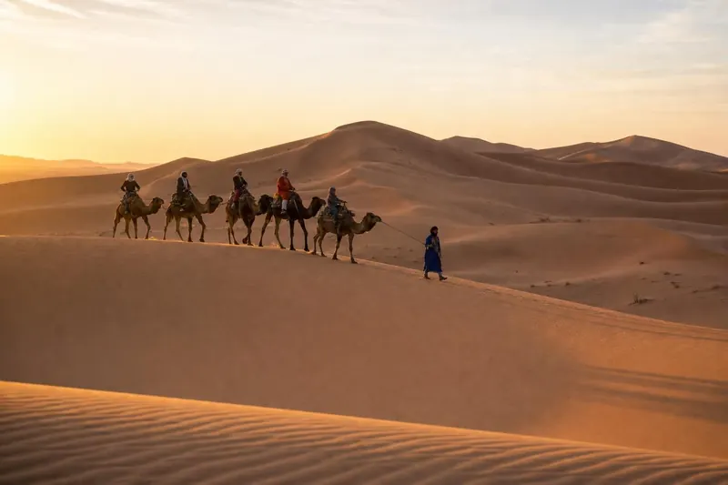
Around four o’clock the camels start to kneel. They fold their front legs first, then the back, and settle onto the sand at the edge of Merzouga with long, patient groans, waiting for riders who are still applying sun cream in the hotel courtyard. Behind them rise the dunes of Erg Chebbi, orange at this hour and turning darker by the minute. A Merzouga camel trek usually begins like this, in the late afternoon heat, with a line of dromedaries tied nose to tail and a guide in a long robe and indigo headcloth who has done the same walk hundreds of times.
Erg Chebbi is a sea of sand on the far western edge of the Sahara, in southeastern Morocco. It stretches about 28 kilometres from north to south and 5 to 7 kilometres across, and in places the dunes rise about 150 metres above the flat, stony desert around them. The Algerian border runs just to the east. Merzouga, a village of low earth-coloured houses, lies along its western side, and most treks into the sand set off from there or from neighbouring Hassilabied.
Plan your visit
- Getting there
- Roughly 560 km by road from Marrakech, usually over two days; nearest airport Errachidia More
- Season
- October to April; cold nights in the dunes, summer days can pass 40 degrees More
- Duration
- Late-afternoon ride out, one night at camp, back in Merzouga by eight in the morning More
- Base
- Merzouga or neighbouring Hassilabied, on the western side of Erg Chebbi More
The drive in from Rissani
The approach to Merzouga crosses a hammada, the flat desert pavement of black stones that covers much of the Sahara, so different from the postcard image of the desert that first-time visitors often wonder where the dunes are. Then the erg appears on the horizon like a range of hills that has been coloured in.
Most travellers come through Rissani, a market town in the Tafilalt oasis about 40 kilometres to the north, and before that Erfoud. The road passes date palm groves, irrigation channels and the ruins of earth-built ksour, fortified villages made of rammed earth and mud brick. Many are now abandoned and slowly melting back into the ground they were built from. Their walls take the colour of the soil so completely that from a distance it is hard to tell where the building ends and the hillside begins.
Meeting the dromedaries
The animals used for trekking here are dromedaries, the one-humped camel of North Africa and Arabia. Close up they are stranger and more appealing than they look in photographs: soft, heavy lips, double rows of long eyelashes that keep sand out of their eyes, and nostrils that can close almost completely in a sandstorm. Their feet are wide, padded and splay out as they step, spreading their weight on soft sand.
A common belief says that the hump holds water. It does not. The hump stores fat, which the animal can break down for energy when food is scarce. Camels save water in other ways, through very efficient kidneys and a body temperature that is allowed to rise during the day and fall at night, so that they sweat less. After a long dry spell, a thirsty dromedary can drink more than 100 litres in a few minutes.
Getting on is the first lesson. The rider sits while the camel is kneeling, then holds the saddle handle hard as it rises, back legs first, so that the rider is thrown forward, then front legs, so that the rider is thrown back. The rolling, swaying gait is very different from a horse’s, and the first half-hour is usually spent learning not to fight it.
Into the dunes at sunset
The guides walk ahead on foot, leading the first camel by a rope, and the line follows the softer ridges and hollows where the climb is easiest. Within twenty minutes the village has disappeared behind the first dune and there is nothing but sand, sky and the shadows of the riders stretched out long and thin across the slope.
The colour of the sand changes with the hour. Mid-afternoon it is pale gold. As the sun drops it becomes orange, then a deep red-brown on the shaded flanks, and the ripples left by the wind stand out as fine lines across every surface. Footprints from the morning’s riders are already half erased.
Most treks stop on a high dune for the sunset. The last stretch is climbed on foot, which is harder than it looks: every step slides back by half, and the summit always seems one ridge further away. From the top, the erg spreads out in every direction, with the hammada visible as a dark plain to the west and the Algerian side of the desert to the east. The sun drops quickly, the sand gives off its stored heat for a while, and then the cold starts.
A night at camp
Desert camps sit in hollows between the dunes, sheltered from the wind and invisible until the last moment. They range from basic goat-hair tents with blankets and a shared toilet to permanent tented lodges with private bathrooms and beds. Most serve the same dinner: soup, bread, salads and a tagine of chicken or lamb with vegetables, followed by fruit and sweet mint tea poured from a height to make it froth.
After dinner the guides light a fire and bring out drums. Some camps invite Gnawa musicians from Khamlia, a small village south of Merzouga. Its families trace their roots to West Africa, and Gnawa music grew from the songs and healing rituals of people brought north across the Sahara over centuries, many of them enslaved. The deep plucked bass of the guembri and the metal castanets called qraqeb give it a sound unlike anything else in Moroccan music. UNESCO added Gnawa to its list of intangible cultural heritage in 2019.
Then the fire dies down, and the sky does the rest.
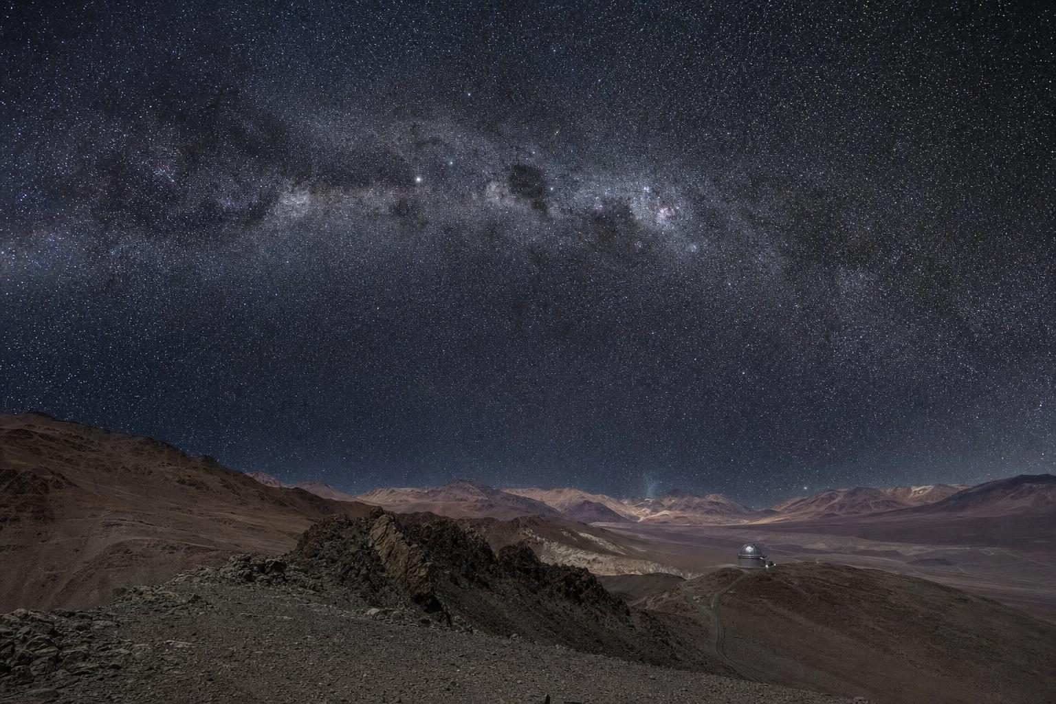
With no town lights for many kilometres, the stars over Erg Chebbi are some of the clearest in North Africa, and on moonless nights the Milky Way stands out plainly. Lying on the cooling sand and watching the sky is the part of the trip that most people remember longest. It is also a reason to come between autumn and spring: summer nights are warm enough for sleeping outside, but the days that precede them are punishing.
Sunrise and the ride back
Guides wake the camp before dawn. The climb to the nearest high dune in the half-dark is cold, and the wait for the sun even colder, but the light that comes up over the eastern ridges is worth it. Within minutes the dunes go from grey to rose to orange, and the shadows of the camels, now waiting below, stretch back across the sand towards the camp.
The ride back to Merzouga is shorter and usually quieter. By eight in the morning the village is in sight again, the hotels are serving breakfast, and showers are washing a surprising amount of sand out of hair, clothes and shoes.
One detour worth a few minutes: Dayet Srji, a shallow seasonal lake on the plain west of the dunes, can fill after rare heavy rains, and when it does, flamingos and other wading birds sometimes stop there on migration. For a while the view from the dunes includes pink birds standing in water in the middle of the Sahara, before the lake evaporates again.
The ruins of Sijilmasa
On the way back north, the road passes the edge of Rissani and the remains of Sijilmasa, about one kilometre north of the modern town. Founded around 757, Sijilmasa became one of the great trading cities of the medieval Maghreb, the northern end of a caravan route that carried gold, salt and enslaved people across the Sahara. The tenth-century geographer Ibn Hawqal wrote of a bill of exchange there worth 42,000 dinars, a sum he had never seen elsewhere.
The city changed hands many times, declined, was rebuilt in the eighteenth century and was finally destroyed in 1818. Today its walls are low mounds of earth, and the World Monuments Fund has listed the site as endangered. Without a guide it is hard to make sense of, but the scale is clear: this was a city, not a village, and almost nothing of it remains above ground.
The area around Erfoud is also known for its fossils, mainly from the Devonian period, around 350 to 400 million years ago, when this desert lay under a shallow sea. Workshops cut and polish slabs of fossil-bearing limestone into tabletops, sinks and souvenirs, and roadside stalls sell ammonites and trilobites, some of them genuine and some skilfully restored.
Planning a Merzouga camel trek
Merzouga is roughly 560 kilometres by road from Marrakech, usually driven over two days with a night at Ouarzazate, the Dadès Gorge or the Todra Gorge. Buses run from Fès and Marrakech, and the nearest airport is at Errachidia, about two hours away by road. Many visitors join a three-day tour from Marrakech that includes the camel trek and one night in the desert.
The main season runs from October to April. Days are warm and pleasant, nights in the dunes are cold, and in midwinter they can fall close to freezing. In summer the daytime heat can pass 40 degrees, a reminder of why the Sahara features on lists of the hottest places on earth. For readers drawn mainly by the night sky, the dark-sky sites in Stellar Synthesis: Stargazing Sites make an interesting comparison, and the earth-built villages of the Tafilalt have a cousin in the carved rock houses described in Cappadocia with the locals.
Bring layers, a scarf to wrap around the face when the wind picks up, sunglasses and a head torch. Leave the large bags at the hotel. And on the way down from the sunset dune, try running: on the steep lee side of an Erg Chebbi dune, the sand gives way softly underfoot, and the descent that took twenty minutes to climb takes about thirty seconds.
Questions before you go
How big is Erg Chebbi?
Erg Chebbi stretches about 28 kilometres from north to south and 5 to 7 kilometres from east to west. In places its dunes rise about 150 metres above the surrounding stony desert, close to Morocco's border with Algeria.
How long is a typical Merzouga camel trek?
The most common trip leaves in late afternoon, rides for one to two hours to a camp in the dunes, and returns at sunrise the next morning. Shorter sunset rides and longer treks of two or three nights are also offered.
When is the best time for a camel trek in Merzouga?
October to April is the usual season, with warm days and cool or cold nights. Summer days regularly exceed 40 degrees, and winter nights in the desert can drop close to freezing.
How do you get to Merzouga?
Merzouga is roughly 560 kilometres by road from Marrakech, usually driven over two days via Ouarzazate and the Dadès or Todra gorges. The nearest airport is at Errachidia, and buses run from Fès and Marrakech.
Do camels store water in their humps?
No. A dromedary's hump stores fat, which it can break down for energy when food is scarce. Camels conserve water through their kidneys and body temperature control, and can drink over 100 litres in a few minutes after a long dry spell.
What is Khamlia known for?
Khamlia is a small village south of Merzouga known for its Gnawa music. Its families trace their roots to West Africa, and Gnawa music, rooted in songs and rituals of people brought across the Sahara, was added to UNESCO's intangible heritage list in 2019.
What was Sijilmasa?
Sijilmasa was a medieval trading city in the Tafilalt oasis, founded around 757 and for centuries the northern end of a trans-Saharan caravan route carrying gold. Its ruins lie about one kilometre north of the town of Rissani.
What should be packed for a night in the desert?
Warm layers for the night, a scarf or headcloth against sun and sand, sunglasses, a head torch and closed shoes for climbing dunes. Large bags are usually left at the hotel in Merzouga, with only a small daypack taken on the camel.
Are desert camps near Merzouga comfortable?
Camps range from simple tents with shared toilets to permanent tented lodges with private bathrooms. The basic standard is a shared meal, blankets and a campfire, and higher-end camps add beds, showers and electricity.