Worldwide · Photo essay
Hottest and Coldest Places on Earth: The Records Behind the Photos
A thermometer at Furnace Creek, a ghost town in the Danakil and a ridge of Antarctic snow mark the limits of the planet's weather. Each one asks something different of a camera.
On 10 July 1913 an observer at Furnace Creek Ranch in Death Valley wrote down 134 °F, or 56.7 °C. More than a century later that single entry is still the official top of the scale, and it is still argued over. Any list of the hottest and coldest places on Earth starts with it, because it shows how thin the line is between a record and a story.
The hottest and coldest places on Earth below run roughly from heat to cold. Some hold official records, some hold claims, and a few are known only from satellites that cannot tell you what a person standing there would feel. All of them can be photographed, though one of them only by a scientist with a very long flight behind them.
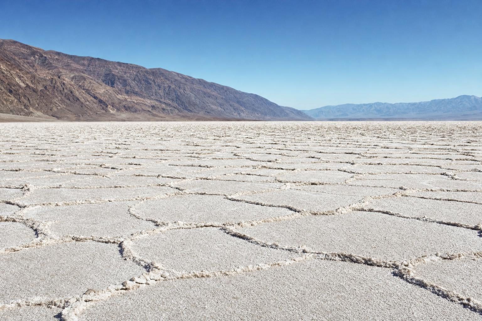
Death Valley and the record that will not settle
Furnace Creek sits on the floor of a long, sunken basin in eastern California, ringed by mountains that trap and recirculate hot air. Badwater Basin, a few kilometres to the south, lies 86 metres below sea level and is the lowest point in North America. Summer air here barely cools at night, and the rock walls keep radiating heat long after dark.
The World Meteorological Organization accepted the 1913 reading after it threw out a rival. For decades the official hottest place on Earth had been ʽAziziya in Libya, with 57.8 °C in 1922. In 2012 a WMO panel decertified that figure, concluding that an inexperienced observer had probably misread a new instrument. Death Valley moved to the top by default.
That did not end the matter. The weather historian Christopher Burt and others have argued that the 1913 figure is several degrees too high, because nearby stations recorded nothing close to it on the same days. A study published in the Bulletin of the American Meteorological Society went further. The WMO has so far kept the record. If it ever fell, the top value would become 54.0 °C, shared by Death Valley in June 2013, Mitribah in Kuwait in July 2016 and Tirat in the Jordan Valley in 1942. Furnace Creek has since logged readings around 54.4 °C in August 2020 and July 2021, and those still await validation.
For a photographer, the heat is the problem and also the subject. The salt polygons at Badwater read best in low, raking light, when every ridge throws a shadow. Zabriskie Point faces the badlands and the Panamint Range and fills with walkers before sunrise. The Mesquite Flat dunes near Stovepipe Wells show wind ripples at dawn that are gone by midday. National park staff ask visitors in summer to stay off trails at low elevation once the day heats up, and to carry more water than seems sensible. Heat haze also softens long-lens shots by late morning, so the useful window closes early.
Dallol, the hottest place people have lived
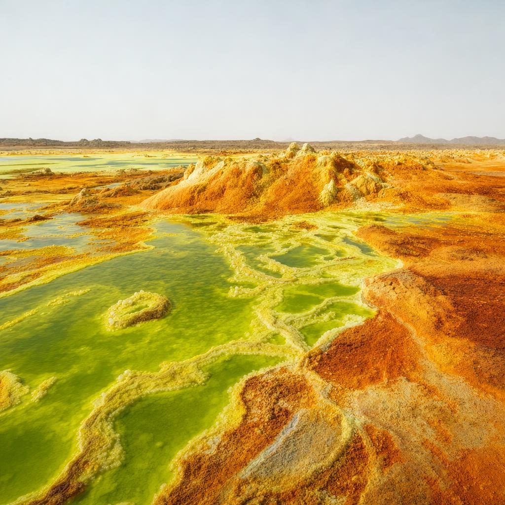
On the other side of the world, the Danakil Depression in Ethiopia’s Afar Region drops well below sea level and holds one of the strangest sights on the planet. Around the low cinder cone of Dallol, hot brine rises through salt and potash deposits and spills into pools of acid green, yellow and rust. The springs run hotter than 108 °C. Some ponds are hyper-acidic, with pH values below one.
The colours are not fixed. Iron compounds oxidise as they meet the air, so a pool that is white one week turns lime, then gold, then orange and finally brown. A photograph from a single visit is a portrait of one moment in a process that never stops.
The name also belongs to a settlement. Between 1960 and 1966 a weather station at Dallol recorded an average annual temperature of 34.6 °C, the highest average ever measured at an inhabited place. The average high in the hottest month was 46.7 °C. Nobody lives there now; the mining town is a ghost town of collapsing salt-block buildings.
In 1917 and 1918 a narrow-gauge railway was laid from the Red Sea port of Mersa Fatma, in what is now Eritrea, to a railhead 28 kilometres from Dallol, so that potash could be carried out of the depression. It opened in April 1918, production stopped after the First World War, and the British administration in Eritrea took the line up after the Second World War. Very little of it is visible from the tour routes today.
Visits are made with local guides from the Afar Region, usually starting before sunrise. That timing is not only about light. The ground heats fast, the acid fumes grow sharper as the day goes on, and the crusts that frame the pools are thin. Footprints stay for weeks, and a boot through a crust can mean a burn. Shoot from established paths, keep the lens hood on against blowing salt, and treat what looks like solid ground as a guess.
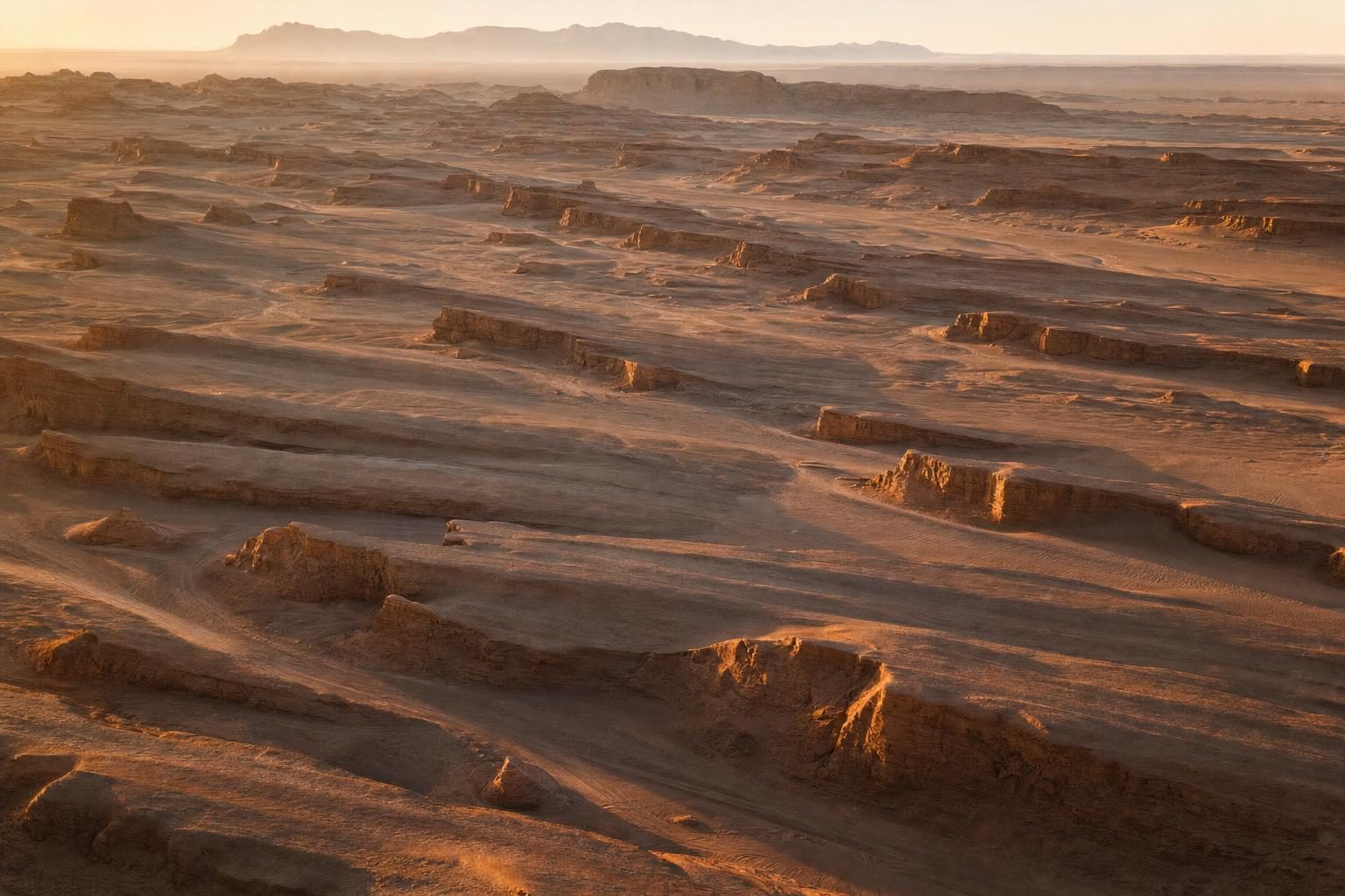
The Lut Desert, where the ground runs hottest
The highest temperatures on Earth are not air temperatures at all. They come from the surface of the ground, which bakes far hotter than the air above it, and the place that keeps topping that list is the Lut Desert, Dasht-e Lut, in south-eastern Iran.
The desert covers about 51,800 square kilometres. Its south-east holds sand dunes around 300 metres high, among the tallest anywhere. In its centre, wind has carved long parallel ridges of rock and sediment, the yardangs, some running more than 150 kilometres across the desert. Much of the surface is dark volcanic rock, and dark ground absorbs sunlight efficiently. UNESCO inscribed the Lut Desert as a World Heritage Site in 2016.
Between 2003 and 2009, NASA’s Aqua satellite measured land surface temperatures across the world’s deserts, and the single hottest reading came from the Lut in 2005: 70.7 °C. Later work with newer MODIS data put the figure at about 80.8 °C, a value also found in Mexico’s Sonoran Desert. These are surface temperatures averaged over large pixels, so the hottest patch of rock was probably hotter still.
The yardangs are the photograph. Low sun from the side turns the ridges into a field of repeated shapes, each with a crisp shadow, and drone images from the edge of the desert show the pattern best. In summer the ground is dangerous by mid-morning. Travellers come in the cooler months and camp at the edges, and anyone heading in needs a local driver who knows the tracks.
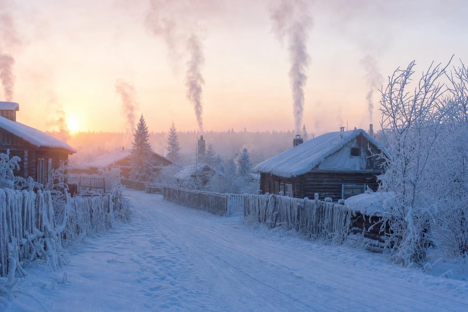
Oymyakon, the coldest town on the map
Oymyakon is a village of a few hundred people on the Indigirka River in Russia’s Sakha Republic, close to the old Kolyma Highway. It is usually called the coldest permanently inhabited place on Earth. The official low, −67.7 °C, was recorded on 6 February 1933 at a weather station in the valley between Oymyakon and the neighbouring settlement of Tomtor. A monument in the village gives a lower figure, −71.2 °C from January 1924, but that reading is unofficial and widely doubted.
The cold here comes from geography. The village sits in a basin where dense, cold air pools on still winter nights, and the ground below is permanent frost. Schools close when the air falls below −55 °C. In December the village receives only about 14 hours of sunshine for the whole month. Summer is a different country: the record high is 34.6 °C, in July 2010, which gives Oymyakon a temperature range of about a hundred degrees.
Cameras struggle long before people do. Batteries lose charge within minutes, plastic grows brittle, and a lens brought indoors fogs inside as well as out. The low winter sun, when it appears, stays near the horizon and turns ice fog pink and gold for hours, which is the reason photographers put up with the rest. Breath freezes on the viewfinder, so a scarf over the mouth and nose earns its place in the bag. The UK Foreign Office currently advises against all travel to Russia, which keeps the village out of reach for many photographers for now.
Vostok and the coldest place on Earth
The lowest air temperature ever measured at ground level was −89.2 °C, at Russia’s Vostok Station in Antarctica, on 21 July 1983. Vostok sits high on the East Antarctic ice sheet, far from any coast, and in the dark of the polar winter its surface radiates heat into a clear, dry sky with nothing to replace it.
Satellites have since found colder ground. In 2013, a team led by Ted Scambos of the US National Snow and Ice Data Center reported snow surface temperatures as low as about −93 °C, measured from orbit along a high ridge between Dome Argus and Dome Fuji. A 2018 paper in Geophysical Research Letters refined the method using data from 2004 to 2016 and found many small hollows on the plateau reaching about −98 °C at the surface. The researchers worked out that the air a couple of metres above those spots would sit only a few degrees warmer.
Those values do not count as official records, because they measure snow, not air in a standard shelter. They still describe the coldest place on Earth in practical terms: shallow dips on a featureless ridge, thousands of metres up, where cold air settles and stays on clear, windless winter nights.
Nobody photographs those hollows in winter. The images that exist come from research stations and from instruments, and the most striking ones are satellite maps where the coldest pockets show as tiny dark points on the plateau. In summer, scientists at Vostok shoot the ice under a sun that never sets, and the one practical lesson they share with Oymyakon is the same: keep the batteries inside the jacket and swap them often.
Packing for the hottest and coldest places on Earth
Pictures from the hottest and coldest places on Earth tend to look calm. The work behind them rarely is. A few rules carry over from the hottest place on Earth to the coldest:
- Work early. Dawn light is softer in the desert and the air is still cool enough to think; at high latitudes, the low sun gives the longest useful light.
- Carry spare batteries close to the body in the cold, and in a cool, shaded bag in the heat.
- Seal the camera in a plastic bag before moving between a heated room and freezing air, and wait until it reaches room temperature before opening it.
- Keep lenses capped and changed as little as possible where salt, sand or acid fumes are in the air.
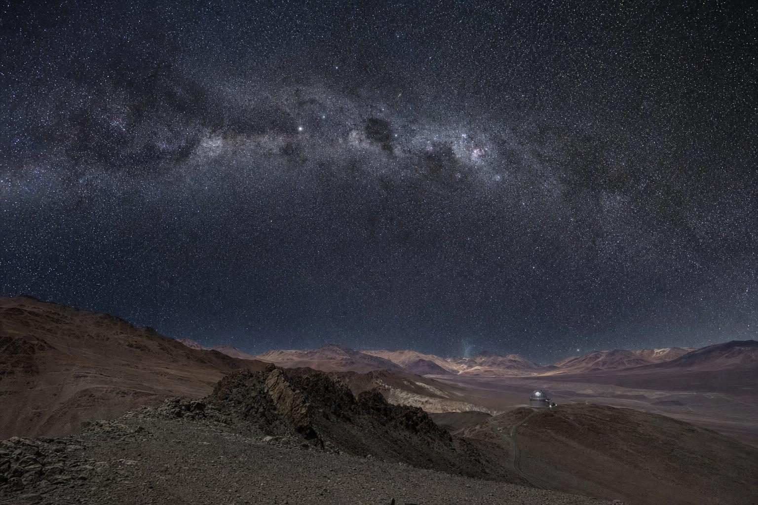
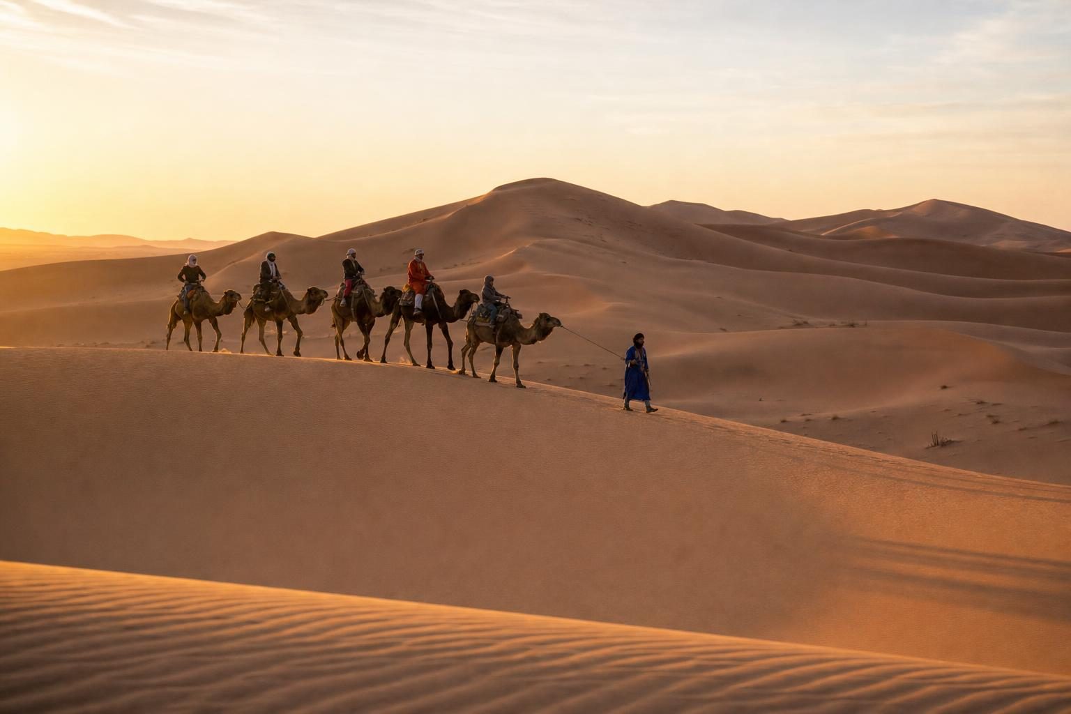
If you want a gentler night-time version of the same extremes, the high deserts on the world’s best stargazing destinations list combine thin, dry air with skies that make cold nights worth the effort. For a slower desert crossing, the camel trek through the Sahara at Merzouga follows the same rule of early starts and midday shade. The Arctic work of the photographer Ashley Cooper shows what happens when the cold places start to warm, and the Kings of the Road trip along Route 66 crosses the Mojave not far from where the heat records were set. More picture-led features sit in the photography section.
At Furnace Creek the visitor centre keeps a large thermometer outside the door, and on hot afternoons a short queue forms in front of it, each person waiting to be photographed next to the number.
Questions before you go
What is the hottest place on Earth by official air temperature?
The World Meteorological Organization still lists 56.7 °C, recorded at Furnace Creek Ranch in Death Valley, California, on 10 July 1913. Several climatologists argue the reading is too high, but the WMO has kept it as the official record.
Why is the Death Valley record disputed?
Weather historians, among them Christopher Burt, consider the 1913 figure implausible compared with readings at nearby stations on the same days. If it were removed, the record would fall to 54.0 °C, a value shared by Death Valley in 2013, Mitribah in Kuwait in 2016 and Tirat in 1942.
What is the coldest place on Earth?
The lowest air temperature measured at ground level is −89.2 °C at Vostok Station in Antarctica on 21 July 1983. Satellite thermal mapping has found snow surfaces on the East Antarctic plateau, between Dome Argus and Dome Fuji, near −98 °C.
Do satellite readings count as temperature records?
No. Satellites measure the temperature of the ground or snow surface over a wide area, not the air at standard height in a screened shelter. They are used in research, but official records rely on station measurements.
How hot does the ground get in the Lut Desert?
NASA's Aqua satellite recorded a land surface temperature of 70.7 °C in the Lut Desert in 2005, and later studies with newer MODIS data reported about 80.8 °C. The air temperature at those moments was much lower than the ground.
What is the coldest inhabited place on Earth?
Oymyakon in Russia's Sakha Republic is usually given that title. Its official low is −67.7 °C, recorded on 6 February 1933, and a monument in the village cites an unofficial −71.2 °C from 1924.
Can people still live at Dallol in Ethiopia?
The old mining settlement at Dallol is now a ghost town. Its average annual temperature of 34.6 °C, measured between 1960 and 1966, remains the highest recorded for an inhabited location.
Can visitors go to Dallol?
Visitors reach Dallol on organised trips through the Afar Region, usually with local guides and police escorts. Access has been suspended at times when the wider region was unstable, so current government travel advice should be checked before booking.
What is the best time to photograph Death Valley?
The cooler months from late autumn to early spring are safest. In summer, photographers work at sunrise and avoid the low-lying salt flats and dunes after the morning.
How should a camera be handled in extreme cold?
Spare batteries kept warm inside a jacket last much longer. When coming indoors, sealing the camera in a bag lets it warm slowly, so condensation forms on the bag rather than inside the lens.