New Zealand · Legend
The Taranaki Legend: How Māori Tell the Battle of the Mountains
Two volcanoes fought over a third, and the loser walked to the sea. The story still explains a river, a lake island and the rain that hides Taranaki for days at a time.
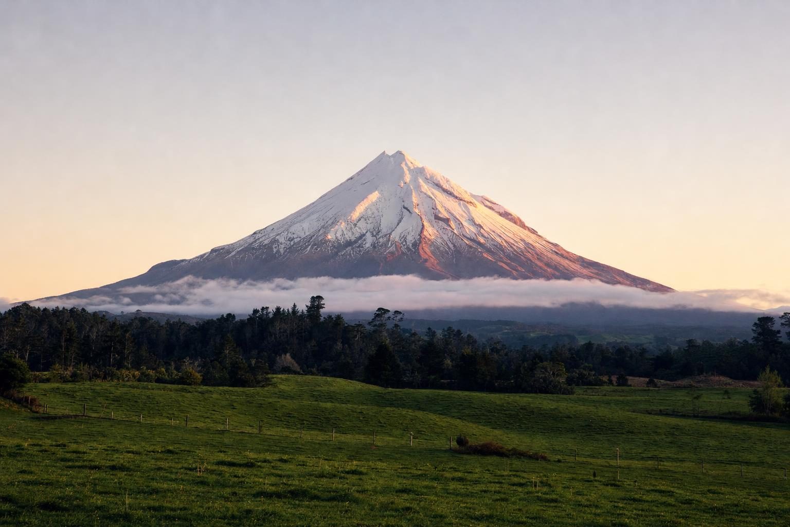
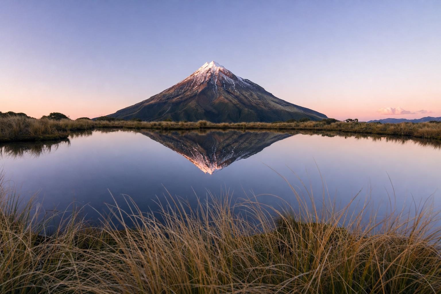
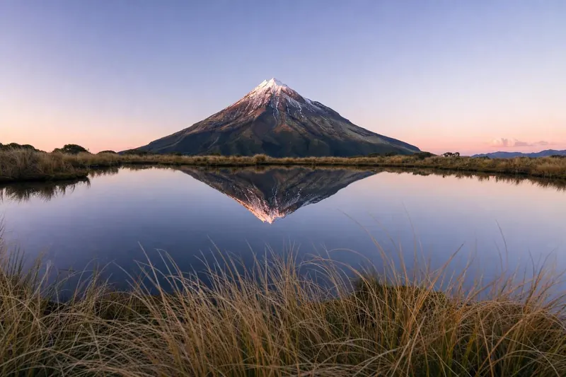
On a clear morning in Taranaki the mountain appears all at once, a white cone above dairy pasture, so even that it looks drawn with a compass. A few hours later it can vanish behind cloud for days. The Taranaki legend has an explanation for both moods, and it begins more than a hundred kilometres to the east, beside a lake, in a quarrel between mountains.
The story belongs to Māori oral tradition, which means it has never had one fixed text. Iwi along the route tell it with their own names, their own resting places and their own emphasis. What follows draws on the widely shared outline, as recorded by Puke Ariki in New Plymouth and by other public sources, and notes where the versions part ways.
The mountains at the centre of the island
In the beginning of the tale, a group of mountains lived together near the heart of Te Ika-a-Māui, the North Island. Ruapehu, Tongariro, Ngāuruhoe and Taranaki stood there, along with Tauhara and others that some tellers name. All were male except one. Pihanga was smaller than the rest, softly shaped, and dressed in a cloak of forest.
Every one of them wanted her.
The rivalry that matters came down to two, Tongariro and Taranaki, the two strongest of the group. Tellers differ on how the contest started and on how long it lasted, but they agree it was violent. The mountains fought with fire and rock, and the ground of the central plateau shook. In the version Puke Ariki records, Tongariro’s head was knocked off in the struggle and landed in Lake Taupō, where it became the island Motutaiko. Anyone who has driven the lake road south of Taupō has seen that island sitting alone in the water, small and round and slightly out of place.
Defeat, and the walk to the west
Tongariro proved the stronger. Pihanga stayed at his side, and Taranaki, beaten, had to leave. Here the Taranaki legend becomes a travel story, and that is the part most closely tied to places people can still visit.
Taranaki did not wander blind. He was led by a stone of great mana, Te Toka-a-Rauhoto, named for Rauhoto Tapairu, a figure in the genealogy linked to the mountain. Some tellers say Taranaki travelled underground, others that he tore across the surface. Either way, his passage cut a long, deep scar across the island. That channel, in most versions, is the bed of the Whanganui River, which still winds through steep bush country from the slopes near Tongariro down to the Tasman Sea.
He rested along the way. Puke Ariki’s account names the Ngāere swamp, near Stratford, as one stop, its low, wet ground the hollow his weight left behind. Other tellers place different pauses on the route. A few versions take Taranaki beneath the sea and up the west coast before he finally surfaced.
When he did, he saw the Pouākai Range, an old, worn volcano on the coast, and he settled beside her. The guide stone came to rest on his seaward side. In this telling Taranaki and Pouākai went on to have many children: winds, rain, plants, rivers, rocks and people. The secondary cone on his southern flank, Panitahi (also known as Fanthams Peak), is, in some versions, a child who travelled with him.
Why tribes spoke of the space between
A long, practical thread runs through retellings collected over the past two centuries. Because Taranaki left in anger, some held that he might one day return to the centre of the island to fight again, and that his path would follow the same scar. Living in the line between the two mountains was therefore considered unwise. The idea appears in travel writing and local histories, though how widely it shaped settlement is difficult to say, and it is best read as part of the story rather than as recorded fact.
It is also said, in popular versions, that when Taranaki is wrapped in rain he is weeping for Pihanga, and that the sunsets which colour his snow are him showing off for her across the distance. Meteorology offers a duller account: the mountain stands alone near the coast and catches moist westerly air off the Tasman, so cloud builds on him far more often than on the farmland around.
Reading the Taranaki legend on the ground
One reason the story has lasted is that the land keeps quoting it. A visitor can trace most of the plot in a week of driving.
Start on the central plateau. Tongariro National Park holds Ruapehu, at about 2,797 metres the highest point in the North Island, the dark cone of Ngāuruhoe and the broad, broken summit of Tongariro itself. The park has its own history worth knowing: on 23 September 1887, Horonuku Te Heuheu Tūkino IV, paramount chief of Ngāti Tūwharetoa, signed a deed giving the peaks to the Crown so they could be protected rather than carved up. That gift became the nucleus of New Zealand’s first national park. UNESCO later listed it as a World Heritage Site for both its natural and its cultural values, among the first places in the world recognised on cultural grounds of that kind.
Pihanga sits just north, above Tūrangi, a forested mass that looks modest beside her neighbours. A short walking track circles Lake Rotopounamu on her flank, and it is one of the quieter places in the region to stand among her trees.
From there the Whanganui River leads west and south. Canoeing it is a multi-day trip through gorges and podocarp forest, and in 2017 the river itself was recognised in law as a living entity, Te Awa Tupua. Then the road runs on to the coast, past Stratford and the low ground near Ngāere, until the cone fills the windscreen.
The guide stone at Puniho
The stone that led Taranaki west was moved in 1948 to Puniho Pā, on State Highway 45 near the coast south of New Plymouth. It sits at the front of the marae. It is a tapu object, so the right way to see it is from the road, or on the invitation of the people of the marae. It is not a roadside attraction and should not be touched.
Te Kāhui Tupua: a mountain that owns itself
The story moved into statute in early 2025. On 30 January, Parliament passed the Taranaki Maunga collective redress legislation, which recognises Taranaki and the surrounding peaks of Panitahi, Pouākai, Patuhā and Kaitake as a single legal person, Te Kāhui Tupua. The act followed similar recognition for Te Urewera and the Whanganui River. Egmont National Park, the old colonial name, became Te Papa-Kura-o-Taranaki, and the park is now managed jointly by iwi and Crown representatives.
For walkers nothing dramatic has changed: the tracks, huts and signs are still there. What has changed is the formal position of the mountain as an ancestor rather than an asset. Iwi of Taranaki have long asked visitors not to stand on the very summit, which is considered the head of the ancestor, and the request carries extra weight now. Climbers still reach the crater rim in summer; many simply stop short of the top rock out of respect.
Different versions, one shape
The variations are part of the point. Some tellers say Taranaki fought several rivals in turn before facing Tongariro. Some add a child of Pihanga whose looks set off fresh suspicion and a second eruption of rage, with the explosion said to have shaped the basin that holds Lake Taupō. Some give Tongariro the grief that fills the river; others give it to Taranaki. Collections of these accounts, including academic studies of the travelling-mountain narrative in Taranaki, treat that flexibility as a sign of a living tradition rather than a flaw. The Taranaki legend has survived precisely because each family could carry its own copy.
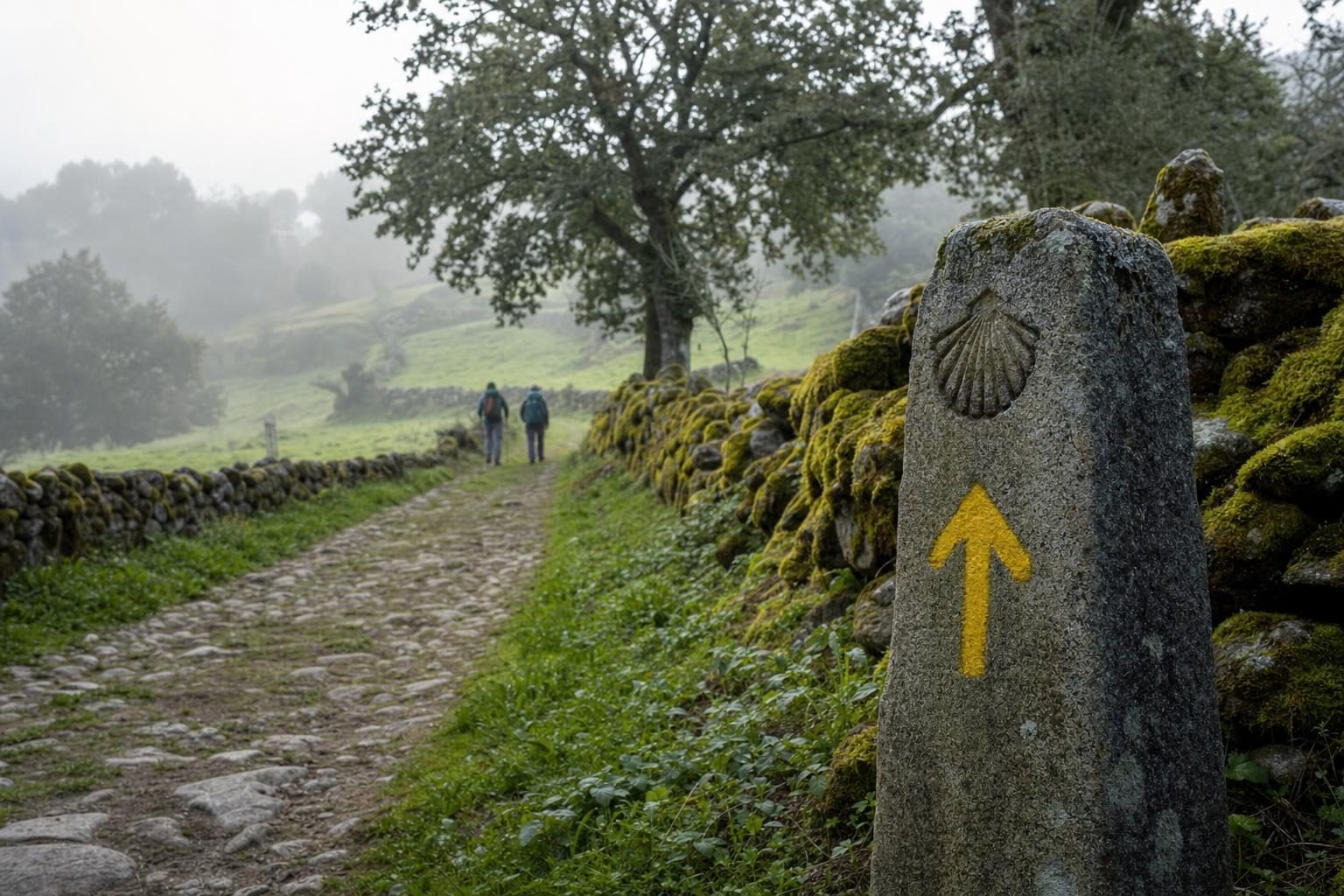
There is a parallel in the way pilgrims elsewhere read sacred ground, attaching stories to rocks and springs along a route. The history of pilgrimage has its own version of that habit, and walking from one mountain to the other in New Zealand can feel similar.
The geology runs a separate timeline. Taranaki is young, built over roughly the last 135,000 years, while the Pouākai volcano beside it has been extinct for around 200,000 years. Taranaki’s eruptions buried much of the older mountain’s ring plain. Read side by side, science and story both describe a newcomer pressing up against an old coastal range.
Walking beside Pouākai
Most visitors who want to stand where the story ends do it on foot. The day-long route over Taranaki’s northern slopes and across to the Pouākai Range is covered in the guide to walking the Pouakai Crossing, and it passes the tarns where the cone reflects on calm mornings. From the Pouākai side the relationship between the two mountains is obvious: the old, eroded range on one hand, the sharp new cone on the other, close enough to touch in the story’s terms.
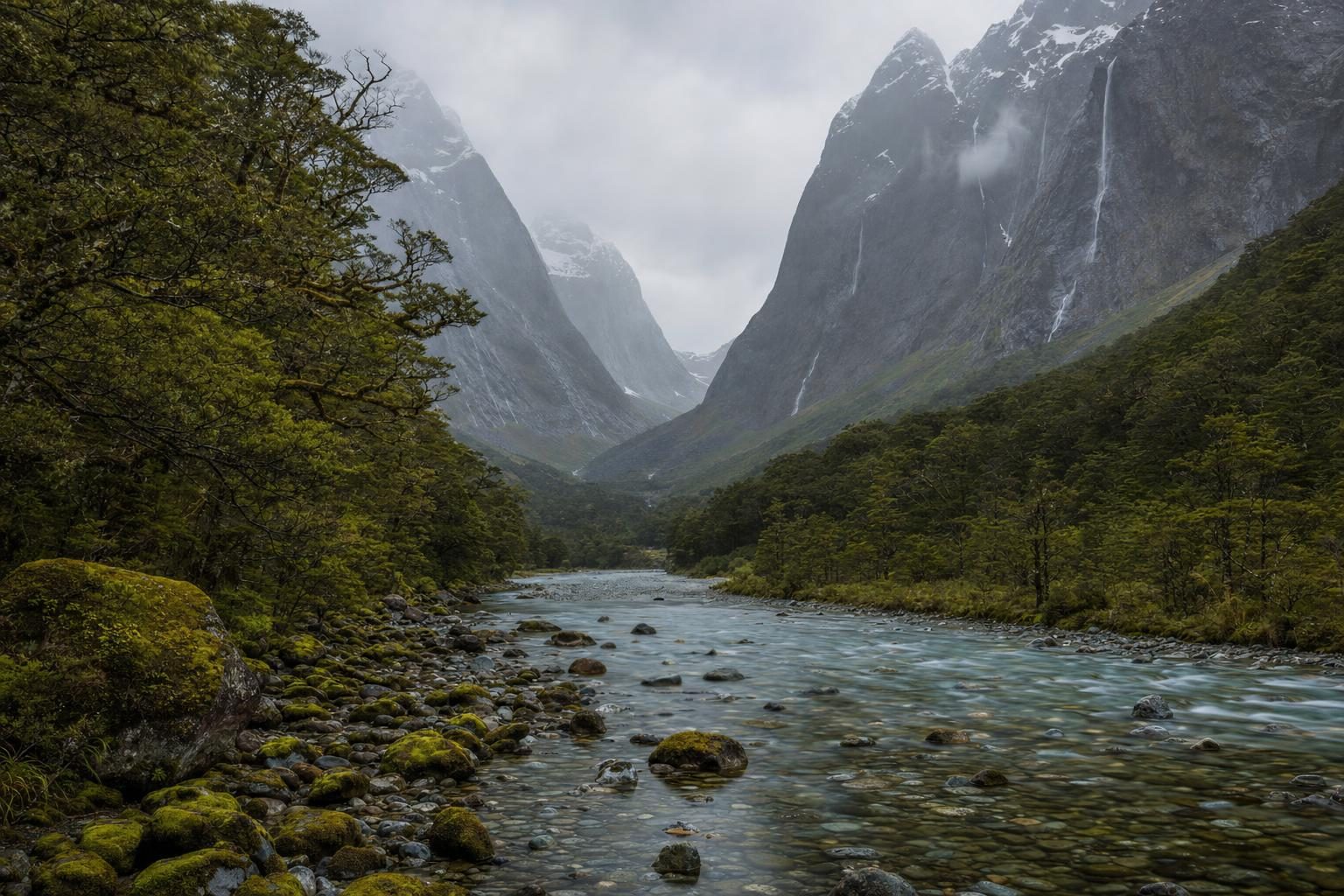
The South Island has its own layered Māori geography, tied to pounamu trails rather than wandering mountains, and the Hollyford valley in Fiordland’s deep south-west is one place to see it.
One small detail tends to stay with people who make the trip in full. On the drive west from the plateau there is a stretch, past Raetihi and on towards the coast, where Ruapehu fades out of the mirror and Taranaki has not yet appeared. For an hour or so neither mountain is visible. Then the road tops a rise in the Taranaki hill country and the cone is suddenly there, sitting exactly where the story left him, facing back east.
If the cloud is down, wait a day. The cone is most often clear early in the morning, before the sea air has had time to build cloud on the upper slopes, so the best view usually comes before breakfast.
Questions before you go
What is the Taranaki legend about?
It tells how the mountain Taranaki once stood in the centre of the North Island beside Tongariro, Ruapehu and others. Taranaki and Tongariro fought over the female mountain Pihanga. Taranaki lost, left for the west coast and settled beside the Pouākai Range, where he stands today.
Who is Pihanga in Māori tradition?
Pihanga is a forested volcanic mountain at the southern end of Lake Taupō, near the town of Tūrangi. In the story she is the only female among the central mountains and the one both Tongariro and Taranaki wanted. She remains beside Tongariro in the tradition.
How does the legend explain the Whanganui River?
As Taranaki travelled away from the centre of the island he gouged a deep channel through the land. In many tellings that channel became the bed of the Whanganui River. Some versions add that water filled it later, or that Tongariro's grief contributed to the flow.
What is Te Toka-a-Rauhoto?
It is the guide stone that led Taranaki west in the story. The stone was later moved to Puniho Pā near State Highway 45 on the Taranaki coast, where it sits in front of the marae. It is a tapu object, so visitors should not touch it or enter the marae without an invitation.
Is the legend told the same way by every iwi?
No. Details differ between tribes and storytellers. Some versions name different rival mountains, others change where Taranaki rested on the way, and some say he travelled underground or beneath the sea. The core of the rivalry over Pihanga and the move west is widely shared.
Does Mount Taranaki have legal personhood?
Yes. Legislation passed in January 2025 recognised Taranaki and the surrounding peaks as a legal person named Te Kāhui Tupua. The same settlement renamed Egmont National Park as Te Papa-Kura-o-Taranaki.
How high is Mount Taranaki?
Taranaki rises to 2,518 metres and is the second-highest mountain in the North Island after Ruapehu. Its near-perfect cone stands largely on its own, which is part of why it looks so different from the clustered volcanoes of the central plateau.
Where can visitors see the mountains in the story?
Ruapehu, Ngāuruhoe and Tongariro sit inside Tongariro National Park, with Pihanga just north near Tūrangi. Taranaki stands about 140 kilometres to the west in Te Papa-Kura-o-Taranaki. The Whanganui River connects the two areas, flowing to the sea at Whanganui.
Why is Taranaki so often covered in cloud?
The mountain stands close to the Tasman Sea and catches moist westerly air, so cloud and rain are frequent. In popular retellings of the legend the rain is described as Taranaki weeping for Pihanga, and the clear days as the mountain showing himself.
When was Tongariro National Park created?
The paramount chief of Ngāti Tūwharetoa, Horonuku Te Heuheu Tūkino IV, signed a deed of gift for the peaks on 23 September 1887. That land became the nucleus of New Zealand's first national park, now recognised by UNESCO for both natural and cultural values.